
🌍 Mapping the Earth
🌐 Why Mapping the Earth is Challenging
- The Earth is nearly spherical 🌏 (slightly flattened at the poles, called oblate spheroid).
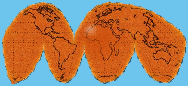
- Representing a sphere on flat paper is difficult → like peeling an 🍊 orange and trying to flatten it → the peel tears at the edges.
- That’s why maps distort shapes, but a globe can represent Earth’s geography more accurately.
🌍 Globe – The True Model of the Earth
- A globe is a miniature model of Earth 🌎.
- It can represent Earth, the Moon 🌙, Mars 🪐, or even stars & constellations ✨.
- It is spherical and usually made of metal, cardboard, or plastic.
- On a globe, Earth’s continents, oceans, parallels & meridians are accurately shown.
🧭 Understanding Coordinates
To locate any point precisely, we need two values (like in chess ♟️ or a market grid).
- In a market: “7th shop in 5th row” → coordinates = (Row, Column).
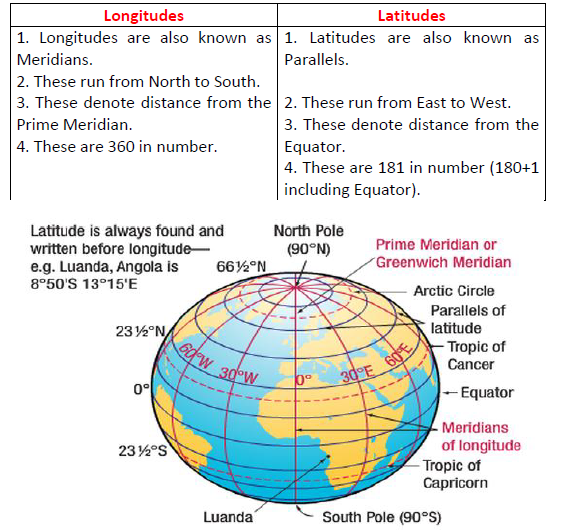
- In chess: Squares marked by letters (a–h) and numbers (1–8). Example: Pawn moves from d2 → d4.
- Similarly, the Earth uses latitude & longitude to give exact coordinates.
📏 Latitudes
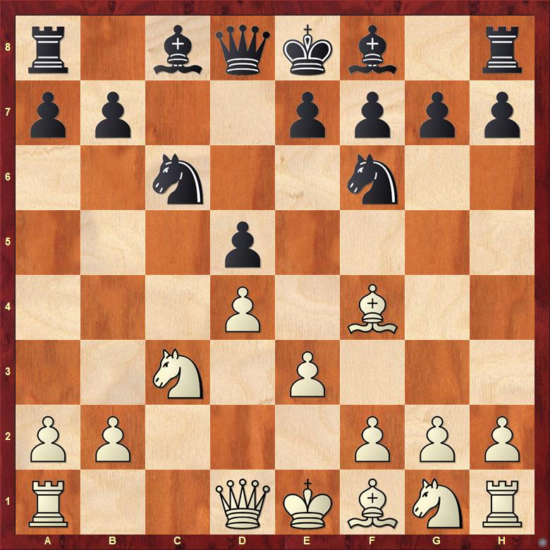
- Imaginary horizontal lines 🌍 running east–west, parallel to the Equator.
- Equator = 0° → largest circle around Earth.
- As we move towards poles, latitudes become smaller circles.
- Poles = 90° North (90°N) & 90° South (90°S).
🔥 Latitude & Climate Zones
- Torrid Zone (0°–23.5° N & S) → Hot 🌞 (near Equator).
- Temperate Zones (23.5°–66.5° N & S) → Moderate 🌤️.
- Frigid Zones (66.5°–90° N & S) → Cold ❄️ (near poles).
📐 Longitudes
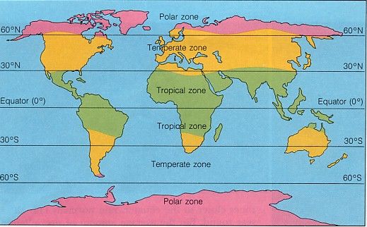
- Imaginary vertical lines 🌍 running from North Pole → South Pole.
- Called Meridians of Longitude.
- All are half circles, equal in length.
📍 Prime Meridian (0° Longitude)
- Passes through Greenwich (London).
- Decided in 1884 as international standard.
- Longitudes measured 0° → 180° East (E) and 0° → 180° West (W).
- Example:
- New York = 74°W
- Delhi = 77°E
- Tokyo = 140°E
👉 Note: 180°E = 180°W → same line (International Date Line 🌏).
⏰ Longitude & Time
- Earth rotates 360° in 24 hours → 15° = 1 hour difference.
- Local time depends on longitude.
- To avoid confusion, countries adopt a Standard Time:
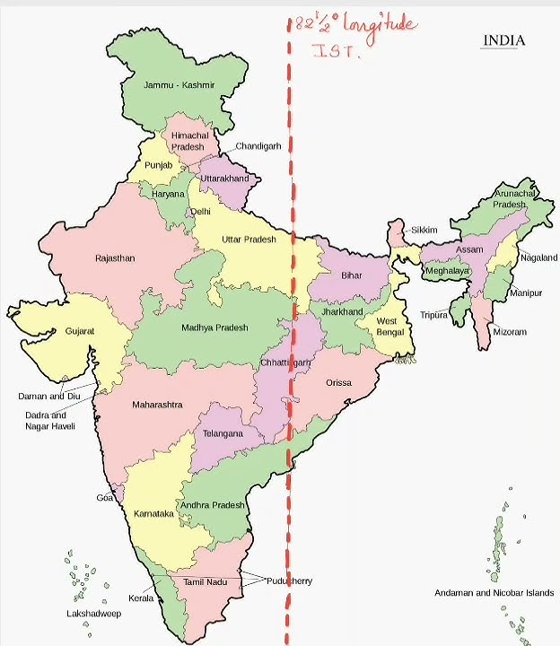
- India (IST) = based on 82.5°E longitude, 5 hrs 30 mins ahead of GMT.
🧾 Key Takeaways
- Globe is the best representation of Earth.
- Coordinates help locate any place precisely.
- Latitude = Distance north/south of Equator.
- Longitude = Distance east/west of Prime Meridian.
- Latitude + Longitude = Grid system 🌍 to find exact location.
- Longitudes help in measuring time zones.